by Arnab Jena
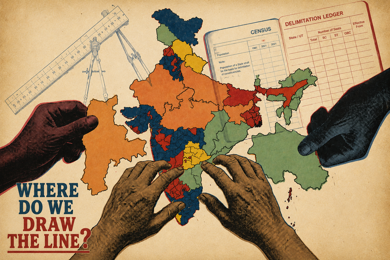
A key function of democracy is to ensure that political representatives effectively represent the interests of all their constituents. In order for this to successfully happen, electoral constituencies must be drawn in a manner that each political representative represents a population of roughly equal size. This ensures that the vote of each person has the same value in representative houses such as the Parliament and State legislatures.
To ensure that each Member of Parliament (MP)An MP represents a constituency in the Lok Sabha (lower house of India's Parliament). or Member of Legislative Assembly (MLA)An MLA represents a constituency in a State Legislative Assembly. represents a population of approximately similar size, each State is divided into territorial constituencies. This process of drawing electoral constituencies based on updated population figures from the Census is known as ‘delimitation’.
While the Constitution enshrines the principle of equality of votes, the situation on the ground tells a different story. The apportionment of seats in the Lok Sabha has not been updated based on a new census since the 1970s. Currently, every person in India has an equal right to vote, however their vote does not have the same value. This freeze has taken the delay to almost six decades as of now, raising several federal concerns about skewed representation in our highest legislative bodies.
What is delimitation?
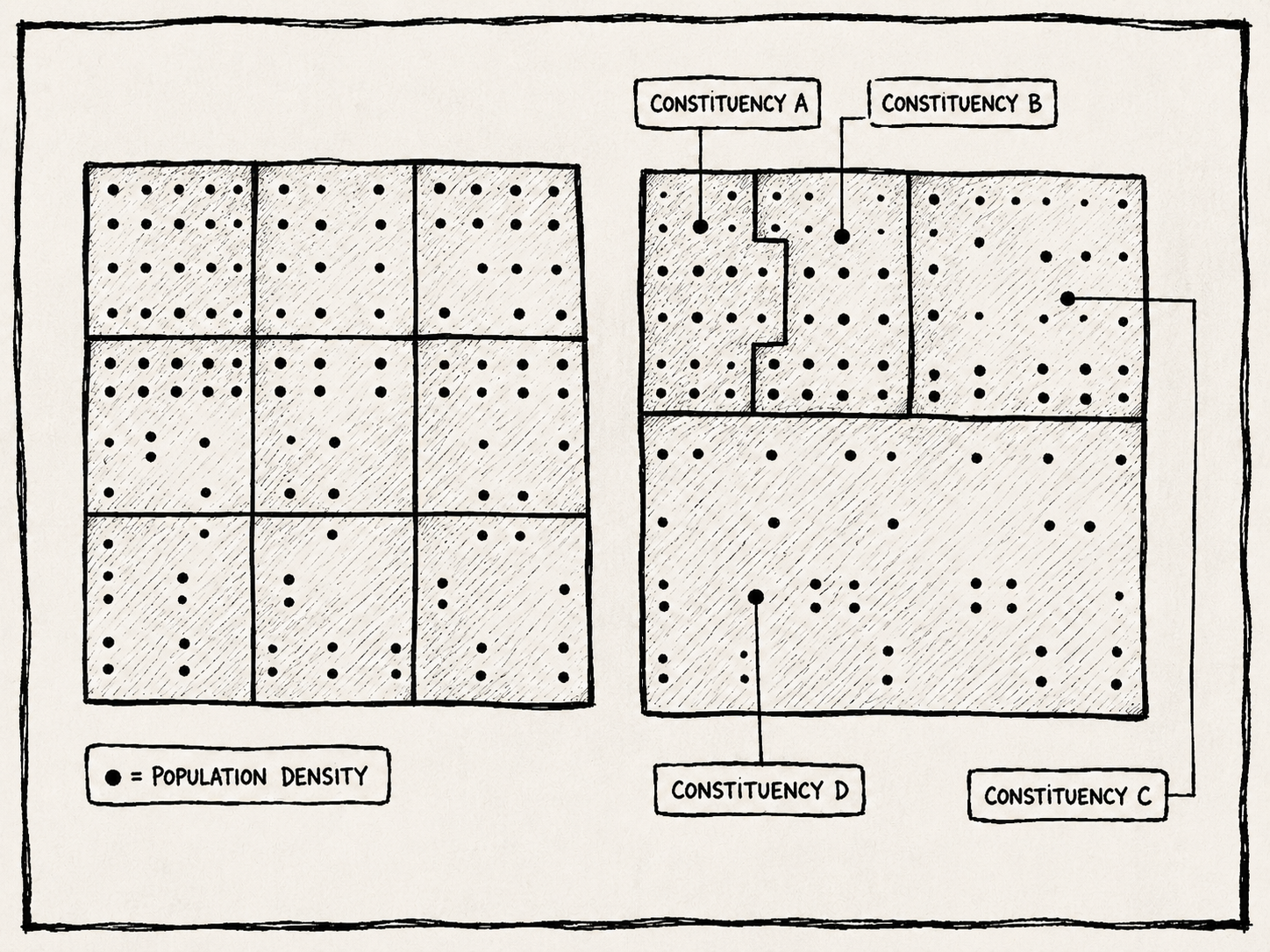
Delimitation is the process of drawing the limits of territorial constituenciesA constituency is a geographically-defined area which comprises of voters who elect a representative to a larger representative body such as the Parliament or the State Legislative Assembly. The elected representative is duty-bound to represent the grievances of the people in their constituency. for elections to representative bodies in India ranging from the Parliament to the State Legislatures, as well as urban and rural local bodies such as Panchayats and Municipalities. The Delimitation Commission, which is an executive body responsible for this task, conducts delimitation, proportionally based on the population. According to this principle, each State is divided into constituent units in such a manner that the population of each unit is more or less the same.
Delimitation translates into a periodic exercise because it is primarily based on population as a factor which is constantly changing. The division into territorial constituencies is required to be readjusted after the completion of every population census. For instance, the last delimitation in 2008 was conducted using the data from the 2001 census. As the law currently stands, there is a freeze on the readjustment of territorial constituencies until the figures of the post-2026 census are published.
Why do we need to talk about delimitation?
The Constitution, in a bid to ensure equality between the values of the votes of different voters in India, requires seats in the Lok Sabha to be allocated to states in proportion to their population.1 Despite the fact that the Constitution mandates that the allocation of seats in the Lok Sabha and the division of each state into territorial constituencies shall be readjusted after each censusThe Census of India is a comprehensive survey providing demographic, social, and economic data of the population, traditionally conducted every 10 years., such periodic readjustment has not followed every Census in India. The last redistribution of Lok Sabha seats between states was done in 1972, more than 5 decades ago!
The 1972 delimitation was based on the 1971 Census.2 Till today 1971 population figures are taken as the base population for redistribution of seats in Lok Sabha.
| Delimitation exercises in India | ||||
|---|---|---|---|---|
| Year started | 1952 | 1962 | 1972 | 2002 |
| Census figures | 1951 Census | 1961 Census | 1971 Census | 2001 Census |
| Number of Lok Sabha Seats | 489 | 494 | 542 | 5433 |
| What was done? | Allocation of Lok Sabha and Assembly seats + Redrawing of constituency boundaries | Allocation of Lok Sabha and Assembly seats + Redrawing of constituency boundaries | Allocation of Lok Sabha and Assembly seats + Redrawing of constituency boundaries | Redrawing of constituency boundaries |
1 The Delimitation Act 1972, art 81.
2 The Delimitation Act 1972.
3 An extra seat was added to accommodate the new State of Sikkim in 1974 by the Constitution (Thirty-fifth Amendment) Act 1974.
Since the 1970s, there has been no change in the number of Lok Sabha as well as State Assembly constituencies. The irregularity in the exercise started in 1976, when the 42nd Constitutional Amendment suspended the revision of seats in Lok Sabha and State Assemblies until after the 2001 Census. This froze the Lok Sabha seats at 543. The freeze was introduced to address concerns of those states that successfully implemented population control measures at that time. In 2001, the 84th Constitutional Amendment further pushed the freeze to 2026, with the relevant population figures to be sourced from the first Census after 2026. As a result of this freeze, India still relies on the 1971 Census for allocation of seats in the Parliament to States!
What about the 2008 delimitation?
The last delimitation was done in 2008 based on the 2001 Census. In 2003, the 87th Amendments to the Constitution, allowed for redistricting within states based on 2001 population figures to account for population changes. However, the 2008 Delimitation order readjusted the boundaries of territorial constituencies without modifying the allocation of Lok Sabha and Assembly seats. Thus, the Lok Sabha seats are still fixed at 543.
Why is that a problem?
By the time the first Census figures after 2026 will be published, the population figures used to allot parliamentary and assembly seats to each state will be 6 decades old.
| Allocation of Seats to States in Lok Sabha | 1971 Census |
|---|---|
| Allocation of Seats to State Assemblies based on population figures | 1971 Census |
| Division of each state into territorial constituencies | 2001 Census |
In the preceding years, the population in India has seen a huge shift. The population in the northern states in India has increased at a relatively faster rate than the population of the southern states that saw prompt implementation of the family planning measures. This has led to under-representation of the more populous states (such as Uttar Pradesh, Bihar) and simultaneous over-representation of the less populous states (such as Kerala, Tamil Nadu) in the Lok Sabha.
This improper representation of states in the Parliament has a direct bearing on the constitutional principles of ‘one person, one value, and one vote’4 as well as ‘federalism and balancing state interest’5, because the value of one vote from each state differs. But how?
4 The Delimitation Act 2002. This democratic principle ensures that every citizen's vote carries equal weight, requiring constituencies to be drawn with roughly equal populations.
5 Census 2011. This principle ensures that the diverse regional interests of different states are equitably represented, preventing more populous states from completely dominating the national legislature.
Note: To bring this data to life, we've built an interactive cartogram. Unlike a standard geographic map, a cartogram physically morphs and distorts the size of each state to proportionally represent the data being discussed in such as population or parliamentary seats. As you scroll down, watch the borders shift to reveal the true scale of India's political and demographic disparities.
Current Map of India
India is a diverse nation with highly unequal population distribution. Uttar Pradesh alone has over 230 million people which is more than the entire country of Brazil. Meanwhile, the five southern states combined account for roughly 250 million. The geographic distribution of India's 1.4 billion people is heavily skewed towards the Gangetic plains.
According to data from the 2011 census, Tamil Nadu and Uttar Pradesh have populations of approximately 7 crore and 20 crore, to their current population?
* Map not to scale, only for representation purpose.
What does this mean?
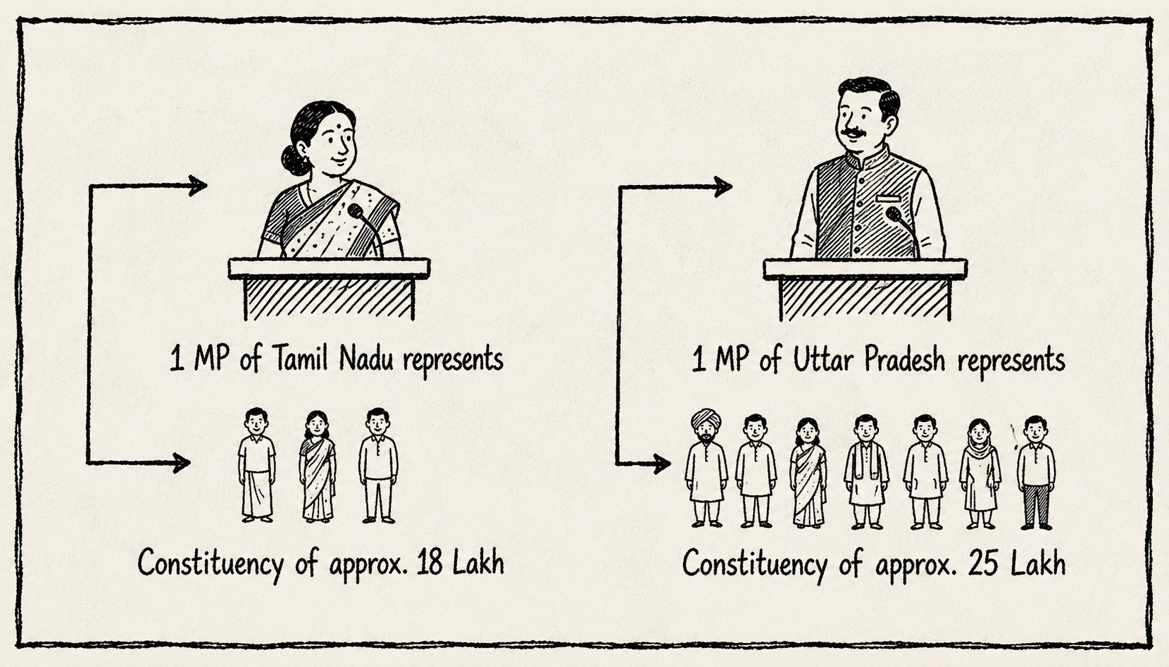
Tamil Nadu currently sends 39 MPs to Lok Sabha whereas Uttar Pradesh, with a population almost three times that of Tamil Nadu, sends 80.
This means that currently, the 543 seats in the Lok Sabha are allocated based on the 1971 census. The 84th Amendment froze this allocation until after 2026. For over 50 years, states have possessed the exact same political power regardless of their population changes to an unprecedented democratic freeze designed to incentivize family planning.
Map: Lok Sabha Seats (1971 Census Allocation)
The Delimitation Commission
Redrawing constituencies is done by the Delimitation Commissiona lengthy, executive-driven process often criticized for lacking transparency and citizen participation.
If post-2026The next delimitation is expected to be based on the 2027 census of India. delimitation relies solely on population, UP could gain 10 seats while Tamil Nadu loses 8. This massive power shift risks skewing national policies toward more populous North Indian states.
Furthermore, the 50-year freeze has created a "knowledge vacuum." With intellectual discourse on delimitation stagnating in India, this lack of understanding poses a serious risk to our representative democracy. But why?
Map: Projected Lok Sabha Seats (Post-2026)
Post-Delimitation Projection
From 1971 to 2021, India's population more than doubled from 548 million to 1.4 billion. But growth was vastly uneven: Kerala's population grew by 65%, while Bihar's skyrocketed by nearly 150%.
A strict reallocation based on projected 2026 populations would see Uttar Pradesh jumping from 80 to 143 seats (+63), and Bihar from 40 to 79 (+39). Conversely, Tamil Nadu would drop from 39 to 31 (-8) and Kerala from 20 to 12 (-8). The balance of power shifts dramatically.
Map: Projected Lok Sabha Seats (Post-2026)
Representative democracyA system of government where citizens elect representatives to make laws and policies on their behalf. is calculated in terms of the ability to influence the decision of the representative (i.e., MP or MLA). When an MP or MLA represents a very large population, it becomes difficult for individual citizens to have their concerns heard, let alone see them translated into concrete actions.
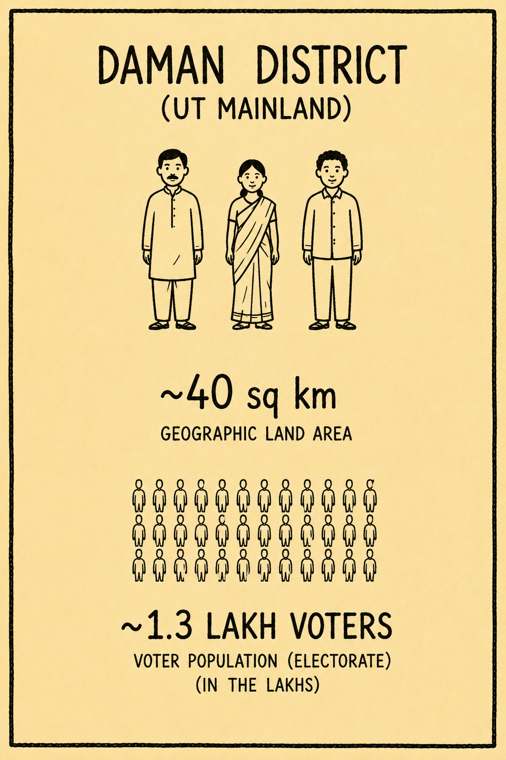
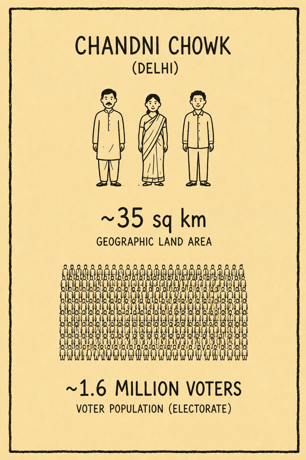
These two constituencies have almost the same geographic area (~35-40 sq km), but Chandni Chowk has over 12 times the number of voters as Daman District!
The larger the constituency, the harder it is for the MP or MLA to effectively engage with citizens, prioritize local issues, and ensure meaningful representation. On the other hand, smaller constituencies have a greater chance of communicating their demands and concerns with their representative. Thus, the quality of representative democracy depends on the size of the constituency.
Note
It is imperative to bear in mind the political implications of any delimitation exercise. Delimitation decides which territorial area and its people form a particular constituency. Thus, constituency boundaries can be drawn to advantage a particular political party in the elections.
Trivia
India is the world's largest representative democracy, with over 900 million eligible voters participating in its electoral process!
Did they cross the line?
Suppose a political party is in power in a State. Traditionally, it happens to gain more votes/supporters in rural areas. Constituencies were redrawn in a way that more villages were merged with adjoining rural areas. This provided an electoral advantage to the party in the next election! The political party that knows the demography of the state is best placed to gain from delimitation this change from rural to urban was used by parties for electoral gains.
A process that has practical bearing on the democracy and political representation of the people in the Parliament should be done in a fair and transparent manner. However, not much information is available on the process that is followed for the Delimitation of Parliamentary and Assembly constituencies in India. This will ensure that the delimitation of electoral constituencies does not become a purely political exercise which is vulnerable to being used by any political party to its own advantage, particularly to gain favourable electoral outcomes.
How is the Delimitation exercise carried out in India?
Even after so many years, the process of delimitation of electoral constituencies from the start to end has remained notably opaque. This is because the Constitution delineates only the overarching principles that must be considered during the delimitation process, while the detailed procedures for carrying out the delimitation exercise are articulated in the delimitation law enacted by Parliament before each delimitation exercise.
Given that the moratorium imposed on delimitation of parliamentary constituencies in India will come to an end in 2026, it is important to understand the procedure that the next delimitation exercise might follow.
Towards this end, we attempted to study the process followed by the Delimitation Commission in the last delimitation exercise (2002-2008). Based on the available information, we have conducted a mapping exercise to understand the stages involved in the delimitation process and the stakeholders involved at each stage.
POPULATION DATA
WORKING
PAPERS
DRAFT PROPOSAL
DELIMITATION ORDER
1. Conduct of Census
Delimitations around the world are prompted by either the passage of a specified time period or a periodic event. Under the Constitution of India, delimitation is prompted by a periodic event - the Population Census. Before any delimitation can occur, a fresh census must be conducted to gather accurate and updated population data across all states and constituencies. Article 82Article 82 provides for the readjustment of Lok Sabha seats and territorial constituencies to the States after every census. of the Constitution of India mandates the conduct of a delimitation exercise after every census.
After the completion of the Census, the Parliament enacts a Delimitation Act for the purposes of redrawing the boundaries of electoral constituencies of the Parliament and of the State Assemblies.
This new Delimitation Act repeals the existing/former Act on Delimitation. For instance, the Delimitation Act 1971 has repealed the Delimitation Act of 1961.
| STAGE | STAKEHOLDERS INVOLVED |
|---|---|
| Completion of the Population Census based on the Census Act, 1948 and the Census Rules, 1990 | The Office of the Registrar General and Census Commissioner, Ministry of Home Affairs |
| The Delimitation Act is drafted | MPs and bureaucrats |
| The Delimitation Act is passed in the Parliament. | MPs + President of India |
| Repeal of the older delimitation Act | Parliament |
2. Publication of Relevant Population Data
The official census figures are published by the government. This data provides the demographic bedrock upon which new constituency boundaries will be calculated.
The Constitution empowers the Parliament to decide the manner in which the delimitation exercise is to be carried out as well as the authority that should carry out the exercise. In India, the Delimitation Act entrusts the task of drawing the Parliamentary and Assembly constituencies to an independent authority. This authority is known as the Delimitation Commission (DC). After the enactment of the Delimitation Act, a new DC is constituted. The DC is constituted by the Union Government. The last DC was appointed in 2002 with the following core members: Present or a former Supreme Court judge as the Chairperson, The Chief Election Commissioner (or his/her nominee) and the State Election Commissioner (or his/her nominee), as members.
| STAGE / EVENT | STAKEHOLDERS INVOLVED |
|---|---|
| Delimitation Commission is constituted | Central Government |
| Delimitation Commission commences its work | Central government, Election Commission of India (ECI), SECs, Governor, and Nagaland, Speakers of Lok Sabha |
| Nomination of Associate Members (AMs) | MPs, MLAs, Speakers of LS and State Legislative Assemblies, political parties, and CEC |
In addition to its core membership, Delimitation Acts have allowed the DC to associate itself with certain MPs from each State and MLAs from each State. For instance, the 2002 Delimitation Act required the Speaker of the Lok Sabha to nominate 5 MPs from every State within two months and the nomination of 5 MLAs by the Speaker of the respective State Assembly within one month of the composition of the DC. The nomination has to be communicated to the CEC as well.
3. Drafting of Working Papers
The next stage involves the preparation of Working Papers by the DC. The DC initially prepares working papers on the following:
- Paper I: District-wise population data and entitlement of assembly seats for each district
- Paper II: Entitlement of seats for Scheduled Castes (SC) in the assembly and distribution of SC seats among the districts
Soon after Papers I and II are prepared by the DC’s office, the same is submitted to the Chairperson of the Delimitation Commission, Election Commission of India (ECI) and the State Election Commission (SEC) of that State. Thereafter, a meeting of the full Commission follows to tentatively approve these Papers I and II. The AMs are first consulted at this stage. There has been little to no guidance in Delimitation Acts on considerations that direct the nomination of AMs by respective Speakers. The absence of any guidance could lead to concentration of AMs from any one political party, costing the DC adequate representation from across parties. Moreover, the AMs do not have the right to vote or sign any decision of the Commission.
- Paper III: SC population in the proposed assembly constituencies and seats proposed to be reserved for SC
- Paper IV: Scheduled Tribes (ST) population in the proposed assembly constituencies and seats proposed to be reserved for ST
- Paper V: Abstract statement of proposed assembly constituencies and total, SC and ST population in each constituency
- Paper VI: District-wise statement showing details of extent, total/SC/ST population in each of the proposed assembly constituencies
- Paper VII: Proposed Lok Sabha constituencies and their extent in terms of proposed assembly constituencies
The working papers are again submitted to the DC for tentative approval after taking into consideration the suggestions of the AMs. At this stage, all tentatively approved working papers are disseminated to the AMs, accompanied by supplementary data and maps. AMs are allotted adequate time to review the proposals and formulate their suggestions. Subsequently, the DC convenes for the second set of meetings with the AMs. The DC evaluates the suggestions of the AMs on the Working Papers, after which the draft proposals of the Commission are formulated.
| STAGE | STAKEHOLDERS INVOLVED |
|---|---|
| Delimitation Commission prepares working papers. | Members of the Delimitation Commission + members of the DC’s office |
| Papers I and II tentatively approved by DC. AMs will be consulted for the first time. | Members of the DC + DC’s office + AMs |
| Papers III to VII tentatively approved by the DC. AMs are consulted. | Members of the DC + DC’s office + AMs |
| Copies of all Working Papers disseminated to the AMs accompanied by supplementary data and maps. | Members of the DC + DC’s office + AMs + The Chief Election Officer of the concerned State |
| AMs are given a reasonable time to study the proposals and formulate their suggestions. | AMs |
| The second round of meeting(s) of the Commission with the AMs. | Members of the DC + DC’s office + AMs |
Who all constitute the office of the DC?
- Deputy Election Commissioner (head);
- One of the ECI Secretaries (who is notified as ex-officio Secretary of the DC);
- Any expert in geographical information system; and
- Four Under Secretaries and around 20 supporting staff are drawn from the ECI.
4. Release of Draft Proposal
At this stage, the Delimitation draft proposal is developed by the Delimitation Commission, incorporating the recommendations of the AMs. A copy of the draft proposal is subsequently sent to each AM. The AMs may submit their objections to any section of the draft proposal at this time as a dissent note.
Concluding Steps
Subsequently, the DC publishes the draft delimitation plan in the Gazette of India and in the Official Gazettes of all relevant States. The dissenting remarks of the AMs are published solely at the request of the AM.
| STAGE | STAKEHOLDERS INVOLVED |
|---|---|
| A Delimitation draft Proposal is prepared by the DC. | Members of the DC + DC’s office + AMs + ECI |
| A copy of the draft proposals is sent to each of the AMs. | Members of the DC + DC’s office + AMs |
| The AMs may send back dissenting notes in respect of any of the draft proposals. | DC + AMs |
| DC will publish the draft proposal together with the dissent note in the Gazette of India and in the Official Gazettes of all relevant States. | DC |
5. Concluding Steps & Publication
The delimitation plan is opened up to the public and their opinions and views are solicited through one or more public sittings. The final delimitation plan/order is published in the official gazette and in at least two vernacular newspapers. This is also publicised on radio, television and other possible media available to the public. The Delimitation Commission becomes inoperative after the final Delimitation Order is published.
| STAGE | STAKEHOLDERS INVOLVED |
|---|---|
| Public opinion and views are solicited on the Delimitation Plan | Citizens, DC |
| All objections and suggestions which may have been received are considered by the DC before the date so specified. | DC, State Governments, participants in public consultations |
| Thereafter by one or more orders (i) the delimitation of parliamentary constituencies; and (ii) the delimitation of assembly constituencies, is determined for each state. | DC |
| After such publication, every such order shall be laid before the House of the People and the Legislative Assemblies of the State concerned. | MPs and MLAs |
V. Key Takeaways
The delimitation process mapping exercise highlighted some concerns around the current process being followed:
The Representation Gap
“One person, one vote, one value.”
— Union Home Minister Amit Shah, defending the need for delimitation.
The freeze on Lok Sabha seats since the 1971 Census has produced striking disparities in representation. While constituency boundaries have continued to be redrawn, the allocation of seats among states has remained unchanged. As populations diverged, so did the number of citizens represented by each MP.
Today, an MP from Tamil Nadu represents roughly 18 lakh people, while an MP from Uttar Pradesh represents around 25 lakh. In practice, this means legislators from larger constituencies face greater demands on constituency services, public outreach, and local issue resolution.
The question facing the Delimitation Commission is whether electoral equality should now outweigh the political compromises made to encourage population control five decades ago.
Hover over the regions to trace their demographic shifts.
Map: Population Distribution (2011 Census)
The Role of Fertility
“States that controlled their population should not be penalised.”
— M.K. Stalin, Chief Minister of Tamil Nadu.
The roots of today's debate lie in India's demographic transition. Southern states achieved replacement-level fertility decades ago through investments in public health, female education, and family planning. Northern states experienced a slower demographic transition and continue to record higher fertility rates.
According to NFHS-5, Bihar's Total Fertility Rate is 2.98, the highest in India, while Kerala (1.7) and Tamil Nadu (1.8) remain well below the replacement level of 2.1.
If parliamentary representation is redistributed purely on current population, states that met national family planning goals earliest fear losing relative political influence because their populations grew more slowly.
Map: Total Fertility Rate (TFR)
Economic Disconnect
The delimitation debate is no longer only about population—it is increasingly about economics.
The five southern states together account for around one-third of India's Gross State Domestic Product despite comprising roughly one-fifth of the national population. Tamil Nadu alone ranks among India's largest manufacturing economies, while Karnataka dominates technology exports and Telangana has emerged as a pharmaceutical hub.
This has prompted several economists to ask whether economic contribution and political representation are beginning to move in opposite directions.
As The Hindu observed, the issue is not merely about parliamentary seats but about preserving the balance between India's demographic and economic realities.
Map: GDP Per Capita (INR)
Tax Contribution
“We contribute more, but our voice may become smaller.”
— A recurring concern raised by several southern Chief Ministers.
Fiscal federalism has become closely linked to the delimitation debate.
According to Finance Commission data, wealthier states contribute a disproportionately larger share of direct and indirect taxes to the Union. These revenues are then redistributed using formulas that prioritize income gaps, population, and development needs.
Studies frequently cited in public debate estimate that for every ₹100 contributed, Karnataka receives roughly ₹15, while states such as Uttar Pradesh and Bihar receive several times their own contribution through transfers. Although redistribution remains a constitutional objective, southern states argue that a simultaneous reduction in their parliamentary influence would weaken their ability to shape future fiscal policy.
Map: Central Tax Contribution vs Return
Development Outcomes
India's demographic divide is also reflected in human development indicators.
Kerala's literacy rate exceeds 94%, compared with around 61% in Bihar. Infant mortality in Tamil Nadu is among the lowest in the country, while several northern states continue to record substantially higher rates despite recent improvements.
For many southern leaders, this creates a paradox: states that invested heavily in education, healthcare, and population stabilisation now fear being disadvantaged in parliamentary representation because those policies succeeded.
As delimitation approaches, the debate has shifted beyond constitutional arithmetic to a broader question:
Should developmental success reduce a state's political influence?
Map: Literacy Rate (%)
Methodology
Data and source documents were acquired from public records including the NFHS-5, the Registrar General of India, Finance Commission reports, and the 2011 Census. The website is built with SvelteKit. For the interactive map views, we utilize D3.js alongside Scrollama to drive scroll-based animations. The geographical data relies on a custom script using an Indian states GeoJSON to dynamically project, align, and render state boundaries and their associated metrics, smoothly interpolating colors and positions as the user progresses through the narrative.
AI Declaration
No core narrative text in this story was 'generated' or written by AI. The authors wrote and rewrote the content, using AI solely for structural formatting, grammar, and spellchecks. The visual components were designed and arranged using classical techniques of conceptualizing and illustrating the data to tell a compelling story.
The author did use AI for coding assistance, meaning internal logic, scroll-based triggers, map alignment algorithms, and Svelte component scripting may have been partially or substantially LLM-generated.
* Data is approximate and used for illustrative purposes.
Back to Indecoded